Trail Walking Nivigne et Suran - chavannes sur suran - Photo
 Mer0708
Mer0708

User

© OpenStreetMap contributors
Length
Length
12 km
Max alt
Max alt
483 m
Uphill gradient
Uphill gradient
330 m
Km-Effort
Km-Effort  
16.4 km
Min alt
Min alt
315 m
Downhill gradient
Downhill gradient
329 m
Boucle
Boucle
Yes
Creation date :
2022-11-08 08:07:08.293
Updated on :
2022-11-08 12:38:50.778

(1 Reviews)

Walking
Walking
3h04
Difficulty : Difficult

Scan this QR Code to open this trail in the SityTrail application

FREE GPS app for hiking

Logo SityTrail SityTrail

IGN / Geographical institutes

Download SityTrail from the App Store Download SityTrail from Google Play

Logo SityTrail SityTrail World

The world is yours!

Download SityTrail from the App Store Download SityTrail from Google Play Download SityTrail on Huawei AppGallery

About

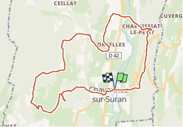
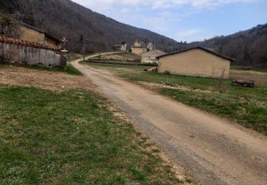
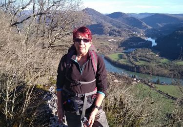
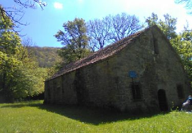
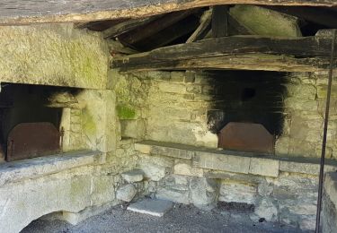
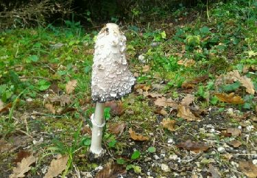
Trail Walking of 12 km to be discovered at Auvergne-Rhône-Alpes, Ain, Nivigne et Suran. This trail is proposed by Mer0708.

Description

Chavannes sur Suran Chavuissiat le Petit le gour

Elevation profile

Positioning

Country:
France
Region :
Auvergne-Rhône-Alpes
Department/Province :
Ain
Municipality :
Nivigne et Suran
Location:
Unknown
Start:(UTM)
687176 ; 5126329 (31T) N.

Comments

Please log in to post a review or rate the element


Trails nearby

Trail Walking Corveissiat - Falaises 1 Corveissiat  - Photo
Walking
Jackoyo

Walking

Very easy
Corveissiat, Auvergne-Rhône-Alpes, Ain, France
10.1 km | 13.5 km-effort
2h 25min
Yes
Trail Walking Corveissiat - arnans abbay de selignac - Photo
Walking
loca.yves

Walking

Easy
Corveissiat, Auvergne-Rhône-Alpes, Ain, France
11 km | 15.7 km-effort
3h 11min
Yes
Trail Walking Val-Revermont - chapelle des conche.depart de montmerle et son observatoire  - Photo
Walking
colomb24

Walking

Very difficult
Val-Revermont, Auvergne-Rhône-Alpes, Ain, France
18.1 km | 24 km-effort
5h 8min
Yes
Trail Walking Nivigne et Suran - chavane sur suran la grotte de l ours - Photo
Walking
colomb24

Walking

Very difficult
Nivigne et Suran, Auvergne-Rhône-Alpes, Ain, France
19.4 km | 28 km-effort
7h 31min
Yes
Trail Walking Corveissiat - corvessiat - Photo
Walking
colomb24

Walking

Easy
Corveissiat, Auvergne-Rhône-Alpes, Ain, France
11.9 km | 16 km-effort
4h 9min
Yes
Trail Walking Nivigne et Suran - Dhuys-Cuisiat - Photo
Walking
Bogapuki

Walking

Medium
Nivigne et Suran, Auvergne-Rhône-Alpes, Ain, France
18.1 km | 28 km-effort
6h 25min
Yes
Trail Walking Matafelon-Granges - bonbois - Photo
Walking
kallentura

Walking

Easy
Matafelon-Granges, Auvergne-Rhône-Alpes, Ain, France
10.3 km | 16.4 km-effort
3h 20min
Yes
Trail Walking Corveissiat - Corveissiat - Photo
Walking
tippex01

Walking

Medium
(1)
Corveissiat, Auvergne-Rhône-Alpes, Ain, France
18 km | 26 km-effort
5h 41min
Yes
Trail Mountain bike Corveissiat - corvessiat 3  - Photo
Mountain bike
registhomas

Mountain bike

Medium
Corveissiat, Auvergne-Rhône-Alpes, Ain, France
16.8 km | 23 km-effort
2h 14min
No


Close
My subscriptions